EditorialCreativeSportsCollectionsVideos
Prices
0Log in

Visual content for professionals.
800M+ images and videos.

Content Hub

  • Current Events
  • Pictures of the Year
  • Sports
  • Editorial
  • Creative
  • Collections
  • Videos

Offers

  • Prices & Packages
  • Promotions
  • Enterprise
  • Newsletter
  • Blog
  • The Game Magazine

Services

  • Content Research
  • Contract Photography
  • API & FTP Push
  • my-picturemaxx
  • Become a Partner

Company

  • About IMAGO
  • Careers
  • News

Help Center

  • FAQ
  • Contact Us
Legal NoticeTerms & ConditionsLicense InformationData PrivacyPrivacy Settings
© 2026 IMAGO
CEPICBAPLABVPA
  1. USA, Hurricane Barry over the Gulf of Mexico - Satellite Images

USA, Hurricane Barry over the Gulf of Mexico - Satellite Images

Jul 13, 2019

The following photos have been selected for you by the IMAGO picture desk on this topic. For more pictures please use the search function.
Images in this collection

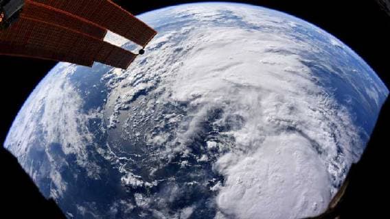
  • July 13, 2019, Earth Atmosphere: Hurricane Barry is a currently active tropical cyclone that has made landfall in the state of Louisiana and is currently threatening the Gulf Coast of the United States. Originating from a mesoscale convective vortex over the Midwestern United States, the system emerged into the Gulf of Mexico on JulyÊ10 and was classified as a potential tropical cyclone later that day. The system developed into a tropical storm on the next day, becoming the second named storm of the annual hurricane season. On July 13, Barry achieved a sustained wind speed of 75 mph (120 km h), becoming the first hurricane of the 2019 season. PICTURED: July 11th. Earth Atmosphere - ZUMAz03_ 20190713_sha_z03_631 Copyright: xNASAx

    July 13, 2019, Earth Atmosphere: Hurricane Barry is a currently active tropical cyclone that has made landfall in the state of Louisiana and is currently threatening the Gulf Coast of the United States. Originating from a mesoscale convective vortex over the Midwestern United States, the system emerged into the Gulf of Mexico on JulyÊ10 and was classified as a potential tropical cyclone later that day. The system developed into a tropical storm on the next day, becoming the second named storm of the annual hurricane season. On July 13, Barry achieved a sustained wind speed of 75 mph (120 km h), becoming the first hurricane of the 2019 season. PICTURED: July 11th. Earth Atmosphere - ZUMAz03_ 20190713_sha_z03_631 Copyright: xNASAx

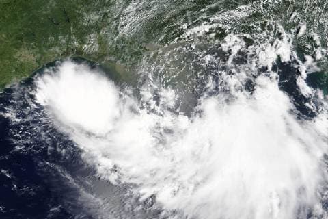
  • The Moderate Resolution Imaging Spectroradiometer (MODIS) onboard NASA s Terra satellite acquired a true-color image of Tropical Storm Barry approaching the Gulf Coast on July 11, 2019. Barry has since increased in intensity and become the first hurricane of the 2019 Atlantic hurricane season. NASA  WAX2019071302 NASA

    The Moderate Resolution Imaging Spectroradiometer (MODIS) onboard NASA s Terra satellite acquired a true-color image of Tropical Storm Barry approaching the Gulf Coast on July 11, 2019. Barry has since increased in intensity and become the first hurricane of the 2019 Atlantic hurricane season. NASA WAX2019071302 NASA

Collections
News