EditorialCreativeSportsCollectionsVideos
Prices
0Log in

Visual content for professionals.
800M+ images and videos.

Content Hub

  • Current Events
  • Pictures of the Year
  • Sports
  • Editorial
  • Creative
  • Collections
  • Videos

Offers

  • Prices & Packages
  • Promotions
  • Enterprise
  • Newsletter
  • Blog
  • The Game Magazine

Services

  • Content Research
  • Contract Photography
  • API & FTP Push
  • my-picturemaxx
  • Become a Partner

Company

  • About IMAGO
  • Careers
  • News

Help Center

  • FAQ
  • Contact Us
Legal NoticeTerms & ConditionsLicense InformationData PrivacyPrivacy Settings
© 2026 IMAGO
CEPICBAPLABVPA
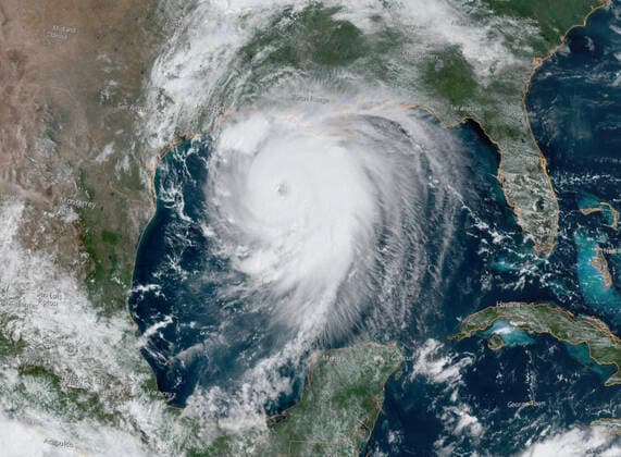
  1. USA, satellite image of Hurricane Laura over the Gulf of Mexico

USA, satellite image of Hurricane Laura over the Gulf of Mexico

Aug 26, 2020

The following photos have been selected for you by the IMAGO picture desk on this topic. For more pictures please use the search function.
Images in this collection

  • August 26, 2020, Gulf of Mexico, USA: Satellite image shows Hurricane Laura in the Gulf of Mexico. Laura is forecast to make landfall along the Gulf Coast as a Category 4 storm. As of Wednesday morning, Laura is a Category 3 storm with maximum sustained winds of at least 115 mph. Forecasters predict a storm surge from 9 to 14 feet when it strikes near the Louisiana Texas border. Gulf of Mexico USA - ZUMAz03_ 20200826_zan_z03_745 Copyright: xNOAAx

    August 26, 2020, Gulf of Mexico, USA: Satellite image shows Hurricane Laura in the Gulf of Mexico. Laura is forecast to make landfall along the Gulf Coast as a Category 4 storm. As of Wednesday morning, Laura is a Category 3 storm with maximum sustained winds of at least 115 mph. Forecasters predict a storm surge from 9 to 14 feet when it strikes near the Louisiana Texas border. Gulf of Mexico USA - ZUMAz03_ 20200826_zan_z03_745 Copyright: xNOAAx

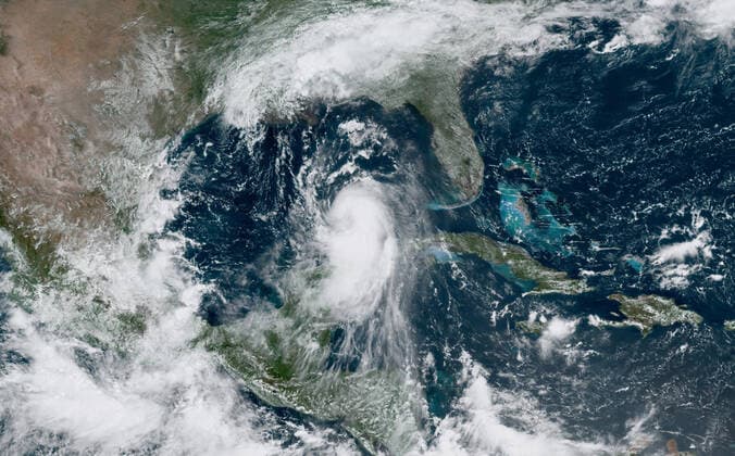
  • August 25, 2020, Gulf of Mexico, USA: Satellite image shows Hurricane Laura in the Gulf of Mexico early Tuesday morning. Laura is forecast to make landfall along the Gulf Coast as a Category 4 storm. As of Wednesday morning, Laura is a Category 3 storm with maximum sustained winds of at least 115 mph. Forecasters predict a storm surge from 9 to 14 feet when it strikes near the Louisiana Texas border. Gulf of Mexico USA - ZUMAz03_ 20200826_zan_z03_743 Copyright: xNOAAx

    August 25, 2020, Gulf of Mexico, USA: Satellite image shows Hurricane Laura in the Gulf of Mexico early Tuesday morning. Laura is forecast to make landfall along the Gulf Coast as a Category 4 storm. As of Wednesday morning, Laura is a Category 3 storm with maximum sustained winds of at least 115 mph. Forecasters predict a storm surge from 9 to 14 feet when it strikes near the Louisiana Texas border. Gulf of Mexico USA - ZUMAz03_ 20200826_zan_z03_743 Copyright: xNOAAx

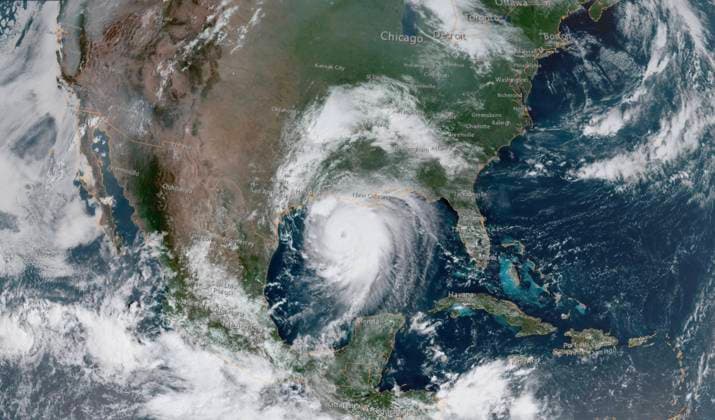
  • August 26, 2020, Gulf of Mexico, USA: Satellite image shows Hurricane Laura in the Gulf of Mexico. Laura is forecast to make landfall along the Gulf Coast as a Category 4 storm. As of Wednesday morning, Laura is a Category 3 storm with maximum sustained winds of at least 115 mph. Forecasters predict a storm surge from 9 to 14 feet when it strikes near the Louisiana Texas border. Gulf of Mexico USA - ZUMAz03_ 20200826_zan_z03_744 Copyright: xNOAAx

    August 26, 2020, Gulf of Mexico, USA: Satellite image shows Hurricane Laura in the Gulf of Mexico. Laura is forecast to make landfall along the Gulf Coast as a Category 4 storm. As of Wednesday morning, Laura is a Category 3 storm with maximum sustained winds of at least 115 mph. Forecasters predict a storm surge from 9 to 14 feet when it strikes near the Louisiana Texas border. Gulf of Mexico USA - ZUMAz03_ 20200826_zan_z03_744 Copyright: xNOAAx

Collections
News