EditorialCreativeSportsCollectionsVideos
Prices
0Log in

Visual content for professionals.
800M+ images and videos.

Content Hub

  • Current Events
  • Pictures of the Year
  • Sports
  • Editorial
  • Creative
  • Collections
  • Videos

Offers

  • Prices & Packages
  • Promotions
  • Enterprise
  • Newsletter
  • Blog
  • The Game Magazine

Services

  • Content Research
  • Contract Photography
  • API & FTP Push
  • my-picturemaxx
  • Become a Partner

Company

  • About IMAGO
  • Careers
  • News

Help Center

  • FAQ
  • Contact Us
Legal NoticeTerms & ConditionsLicense InformationData PrivacyPrivacy Settings
© 2026 IMAGO
CEPICBAPLABVPA
Back to collections

North America: Satellite image shows the spread of smoke from the Canadian wildfires

Jul 14, 2026

The following photos have been selected for you by the IMAGO picture desk on this topic. For more pictures please use the search function.
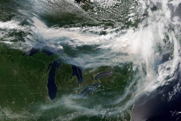
  • July 14, 2026, Toronto, Ont, Canada: Satellite image showing smoke from multiple wildland fires pours eastward over Canada and the United States, July 14, 2026, from Earth Orbit. At least 830 wildfires were burning in Canada, along with more than a dozen in northern Minnesota, forcing mandatory evacuations and spreading unhealthy smoke down to the Lower 48. Toronto Canada - ZUMAp138 20260714_zaa_p138_033 Copyright: xLaurenxDauphin NasaxGsfcx